HMP e-Logbook
As the field season progressed, the MIT team recorded and posted daily a record of their activities, along with a few selected photos.
The field site's logbook has been duplicated here.
July: 8 10 11 12 14 15 16 17 18 19 20 21 22 23 24 25 26 27 28 29 30 31 August: 1 2 3 4-6
August 1, 2005
Written by Jessica Marquez
In preparation for Sarah's departure from camp, we held an organizing meeting to evaluate the remaining tasks for the field season. Among the tasks remaining is to complete the inventory of the consumable items that will remain on camp for the winter season. Since Sarah has undertaken the food inventory pre-2005, Julie and Jessica will only have to look into the 2005 food.
The ATV RFID experiment was taken down today. All the ATVs had been tagged for a week or so, thus we collected data for all that time period. We left one set of RFID tags on an ATV as a test to see if it would survive the winter. Since we know the RFID readers will not last the winter, they will be taken back to MIT for further testing and data collection.
Sarah, Jessica and Julie also set out to refine the kitchen inventory that had been conducted earlier in the field season. This included itemizing pots, pans, kitchen utensils, bowls, and eating utensils. This information will provide the current and future cooks of the camp a better idea of what might be needed in future seasons. For example, there is a lack of small pots, which are sometimes necessary to make sauces and making small vegetarian dishes for individuals.
Jessica and Julie also conducted an observation of a planning meeting for a long excursion. This time Pascal Lee, Jeff Hoffman, Mario Runco, Steve Hart (the new flight surgeon on camp from NASA JSC), as well as the Discovery Channel film crew set out to the north-northeast of camp near the ocean to go and conduct a photographic survey of gullies. This site is an unexplored area, though Pascal has seen it from helicopter before, thus it will provide another data point in our different types of excursions that we are quantifying and observing.
The following is a detailed description of the traverse to Discovery Bay, written by Jeff.
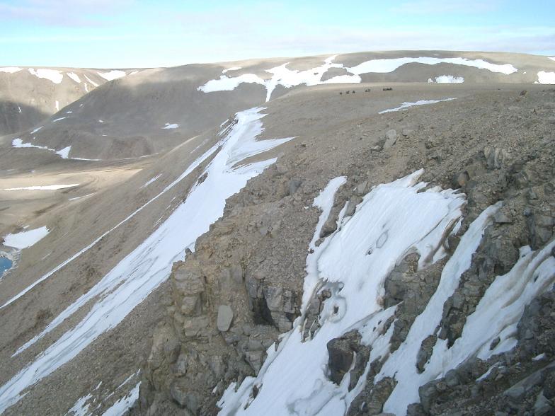
After our 31 July "preparatory" EVA traverse into the Houghton Crater, it was time to go further afield. Aerial photographs from the 1950's Canadian Arctic Survey show some cliffs along the arms of some fjords which form the Thomas Lee inlet, cutting into Devon Island from the Arctic Ocean . Some of the cliffs show gullies. The discovery several years ago of gullies on Mars created a lot of excitement because of the possibility that they were created by liquid water seeping out, and with liquid water (at least on Earth) is the possibility of life. Pascal Lee, project leader, wanted to get to these gullies and take both soil and water samples at the top and further down into the gullies. Back in the lab, the samples will be analyzed for microorganisms, and the question is whether the living content increases towards the bottom of the gullies. This is a little different than looking at the erosion skirt at the base of the gullies, since a lot of other material can accumulate in the skirts, as opposed to the gullies themselves. If a biotic enhancement is not present in these Mars-like gullies on Earth, then it is probably not worth going to special pains to sample these sites on Mars, which involves difficult access on cliff faces. On the other hand, if these gullies really do enhance life, then they are a good place to look on Mars.
Pascal had flown around these cliffs once on a helicopter, but nobody had ever done a traverse over there. There was a "road" about a third of the way, and after that we would be on our own. Having a GPS, I became the de facto navigator. We put in a few waypoints from the topo map. A four-person team from the Canadian Discovery Channel accompanied us. They are doing a six-part documentary called "Mars Rising" covering many aspects of the current and future exploration of Mars. (They will be coming to MIT at the end of September to look at some robotic experiments and our work on Space Suits.) Also along were Mario Runco, another former astronaut, a JSC flight surgeon, and an Inuit helper who took up the rear as "shotgun". Several bear dens were seen near the cliffs during the helicopter flight, so you can't be too careful.
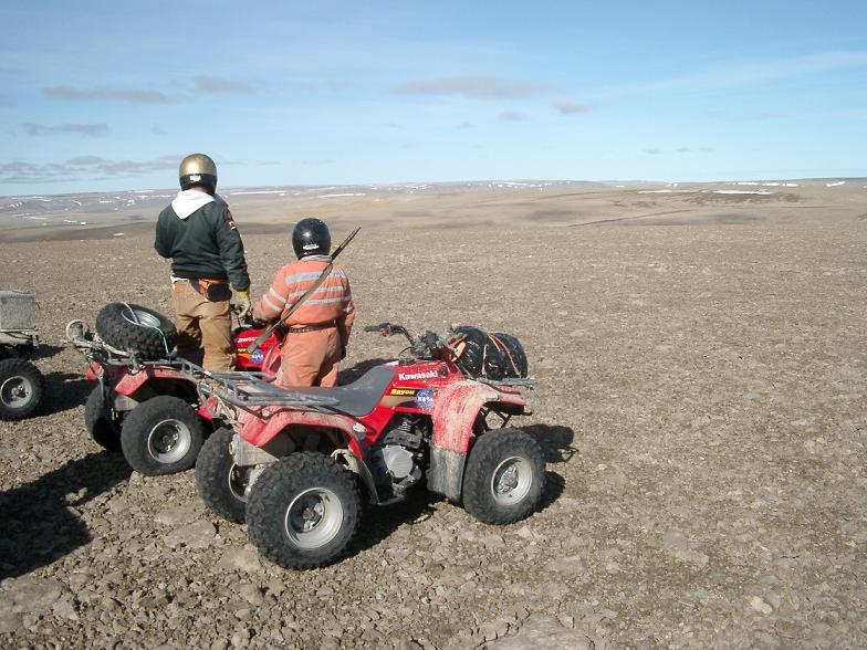
As the crow flies, the goal was only 8.5 miles away, but the terrain was extremely difficult. Our preparatory traverse was extremely wet, with lots of mud. Yesterday's traverse, in contrast, was mostly dry but extremely tough. I am amazed at the terrain that these ATVs can handle. I swear I drove over some rocks which looked like razor blades which I would not have wanted to walk on, let alone drive. We had to take an extremely circuitous course, winding around valleys, rivers, talus fields, etc. Total driving distance, per GPS, was 15.1 miles, so almost 2:1 over the direct distance. Average speed was 6 mph, compared to maximum speed of 22 mph on the occasional smooth flats. Only once did we have major problems. We went down a very steep slope to a river bed in order to see if we could drive around to the base of the cliffs. When we got down to the bottom, we found that the terrain was impassable, even with ATVs, so we started back up. Unfortunately, the slope was loose scree, and all the ATVs except one got stuck. I was able to get mine out by dismounting and "driving" while walking alongside for a short distance. Other people gave up, and our Inuit guide took the ATVs up via a roundabout route. Luckily, nobody got hurt and we didn't damage any of the ATVs.
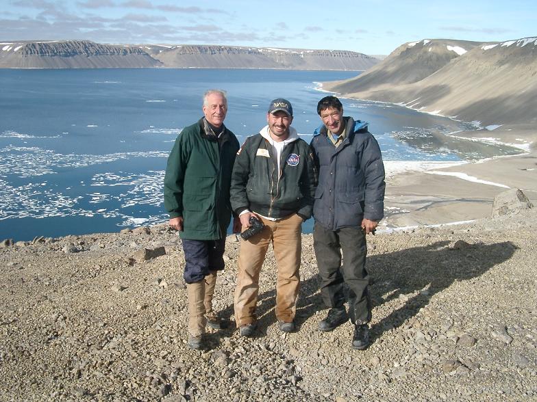
Arriving at the high point where we got our first view of the water, we all felt a surge of excitement. Sort of a Xenophon moment — "Thallassa..." The water had a lot of floating ice, on which we saw one seal sunning itself. No bears were anywhere in sight, luckily. The sampling itself took all of 20 minutes, then we shot some footage for the show and headed back.
The total traverse lasted almost 9 hours. Some of this was devoted to filming, but still, it shows how limited astronauts will be on Mars in how much territory they can explore in one-day chunks, even if they have ATVs. 8 hours is a long EVA! I think this kind of situation shows the value of a mobile overnight base that can be towed by the ATVs to an interesting site which can then be explored for an extended period and possibly left there while the crew returns periodically to base camp. People planning the exploration of the Moon and Mars need to appreciate the limitations of mobility.
I'm not sure I would have wanted to do that drive in a space suit, especially when we were trying to get the ATVs unstuck! I'll have a chance to drive an ATV in the Hamilton Sundstrand test spacesuit later today or tomorrow.