The Haughton-Mars Project
Final Report:
For six weeks during the summer of 2005, a group of researchers from the department of Aeronautics and Astronautics at the Massachusetts Institute of Technology (MIT) participated in an expedition to the Haughton-Mars Project Research Station (HMP RS) on Devon Island, Canada (www.marsonearth.com). The MIT team went to Devon Island as part of the annual HMP field campaign to investigate the applicability of the project and the site as an analog for planetary base micro- and macro-logistics, to obtain lessons learned for Supply Chain Management (SCM) to remote environments, and to begin collecting data for modeling purposes. We also tested new technologies and procedures to enhance the ability of humans and robots to jointly explore remote environments on the Earth, the Moon, and Mars.
Extensive information is available on our HMP 2005 website, including the daily logbook, photos, publications, and a data archive.
Main Objectives
The MIT team had 4 main objectives for the 2005 summer field season.
-
Inventory
First, a complete inventory of the HMP RS was compiled for future modeling and to create a "complete picture" of the current state of operations. The inventory was partitioned into a taxonomy developed by the MIT team, and incorporated into an SQL relational database for retrieval using multiple "use cases". The taxonomy contains 10 major classes of supply according to a high-level functional decomposition of research, habitation and maintenance related functions on base. It represents a significant advance over current practice for the international space station (ISS) and Antarctic logistics, where multiple fragmented inventories exist between organizations, leading to misunderstandings and expensive or dangerous under- or oversupply situations affecting those research stations. As a whole, approximately 2300 items were inventoried, including items for overall base operations—such as fuel and other consumables—and items for specific research projects such as the Arthur Clark Mars Greenhouse, C-band satellite communications equipment and CSA telemedicine kit. In a wider sense this objective will help establish a benchmark model for how to efficiently operate a multi-national, multi-organizational research base in a remote environment.
-
Network Modeling
A second major objective for the MIT team was to create and quantify an initial network model of the HMP supply chain. This network model will be used as a benchmark for a comprehensive interplanetary exploration logistics discrete event simulation. The simulation will have the ability to capture flights of vehicles in and out of base and to capture the associated forward and reverse cargo flows. Combined with powerful bin packing and network optimization algorithms this model will help HMP managers organize and plan Twin Otter flights (cargo missions) more efficiently than currently possible. Based on the difference between the planned and actual number of required flights (20 vs. 28) in this field season the team estimated that the transportation optimization potential of HMP may be on the order of 30-40%.
-
Radio Frequency Identification (RFID)
Third, the MIT team experimented with radio frequency identification (RFID) technology to ascertain both its potential benefits and limitations in the context of remote base operations. The basic ability to associate an object with information and then to autonomously track the location and state of assets, agents and vehicles, has the potential to help many aspects of surface operations. Most obviously, it could save researchers precious time by accurately and effortlessly tracking objects as they move about base, while reporting exact levels of supply. It could also enable more exotic applications, such as the rapid "check-out" of a vehicle for traverse using hand-held readers; by creating "smart shelves" that sense what items are on them, it could also save researchers precious time locating and analyzing rock and soil samples that are obtained during field excursions.
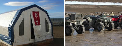
Still, many questions remain about the basic utility and limits of the technology. RFID testing at HMP this summer therefore had two elements: formal scientific studies, and less formal experimentation with the basic technology as lessons were learned about base operations. Formal studies included an experiment to evaluate the benefits of RFID in terms of accuracy and time-savings compared to other technologies such as bar-coding. A system was also developed to precisely monitor the flow of all-terrain vehicle (ATV) traffic in and out of camp. Preliminary results of these studies suggest, among other points, that while RFID technology will undoubtedly save time, basic improvements in accuracy and system design will be needed to justify their cost and mass. Most likely, special packaging would be needed to overcome basic problems of radio-wave reflection and attenuation. Further, it became clear that to avoid RF interference an RFID system needs to be designed together with the overall communications architecture of the base, rather than retrofitted as an afterthought.
-
Extra Vehicular Activities (EVA) Logistics
The fourth major goal for the MIT expedition was to establish logistics requirements for extra vehicular activities (EVAs), through observations of short ATV traverses and longer excursions with overnight stays away from base camp. This goal links EVA planning to the micro-logistics modeling efforts. MIT researchers accompanied geologists on excursions into the Haughton crater and other areas on Devon Island, recording planning strategies—re-planning in the case of unexpected events or discoveries—supplies taken along, and caching possibilities (e.g. via air delivery). Altogether eight traverses or "EVAs" were investigated.